.jpg)
Ston
|
Coordinates: 42°50′N 17°42′E / 42.833°N 17.7°E / |
|
|
Country |
|
|
County |
|
|
Government |
|
|
- Mayor |
Vedran Antunica |
|
0 m (0 ft) |
|
|
Population (2001) |
|
|
- Total |
2,605 |
|
- Summer (DST) |
|
|
Postal code |
20 230 |
|
020 |
|
|
DU |
|
|
Website |
|
Ston is a village and municipality in the Dubrovnik-Neretva County of Croatia, located at the south of isthmus of the Pelješac peninsula. The town of Ston is the center of the Stonmunicipality.
Population
According to the 2001 census, municipality of Ston has population of 2,605. Croats make up an absolute majority with 98.66% of the population. [1]
Geography
The municipality of Ston include following settlements, with respective populations (census 2001):
- Ston, 528
- Žuljana, 218
- Hodilje, 214
- Metohija, 168
- Mali Ston, 165
- Zaton Doli, 158
- Dubrava, 145
- Sparagovići, 136
- Tomislavovac, 112
- Putniković, 105
- Broce, 100
- Boljenovići, 94
- Brijesta, 78
- Duba Stonska, 40
- Zabrđe, 67
History and features
Ston was a major fort of the Ragusan Republic whose defensive walls were regarded as a notable feat of medieval architecture [2]. The town's inner wall measures 890 metres in length, while theGreat Wall outside the town has a circumference of 5 km. The walls extend to Mali Ston ("Little Ston"), a smaller town on the northern side of the Pelješac isthmus and the end of the Mali Ston Channel (Malostonski zaljev), notable for its mariculture.Ston is also known for its saltworks which were run by the Republic of Ragusa and the Ottoman Empire.
Walls of Ston
The Walls of Ston are a series of defensive stone walls, originally more than 7 kilometre (4.5 mile) long, that have surrounded and protected the maritime city-state of Dubrovnik (Ragusa), situated in southern Croatia.
Despite its small size, the Republic of Dubrovnik was well protected by massive city walls and used Pelješac to build another line of defense. At Pelješac's narrowest point, just before it joins the mainland, a wall was build from Ston to Mali Ston.
Today's 5.5 kilometre (3.5 mile) long wall that links these two small communities is in the shape of a pentagon was completed in the 15th century, along with its 40 towers and 5 fortresses. Wall meant to protect the precious salt pans that contributed to Dubrovnik's wealth, which are still being worked today. It is the longest wall in Europe .
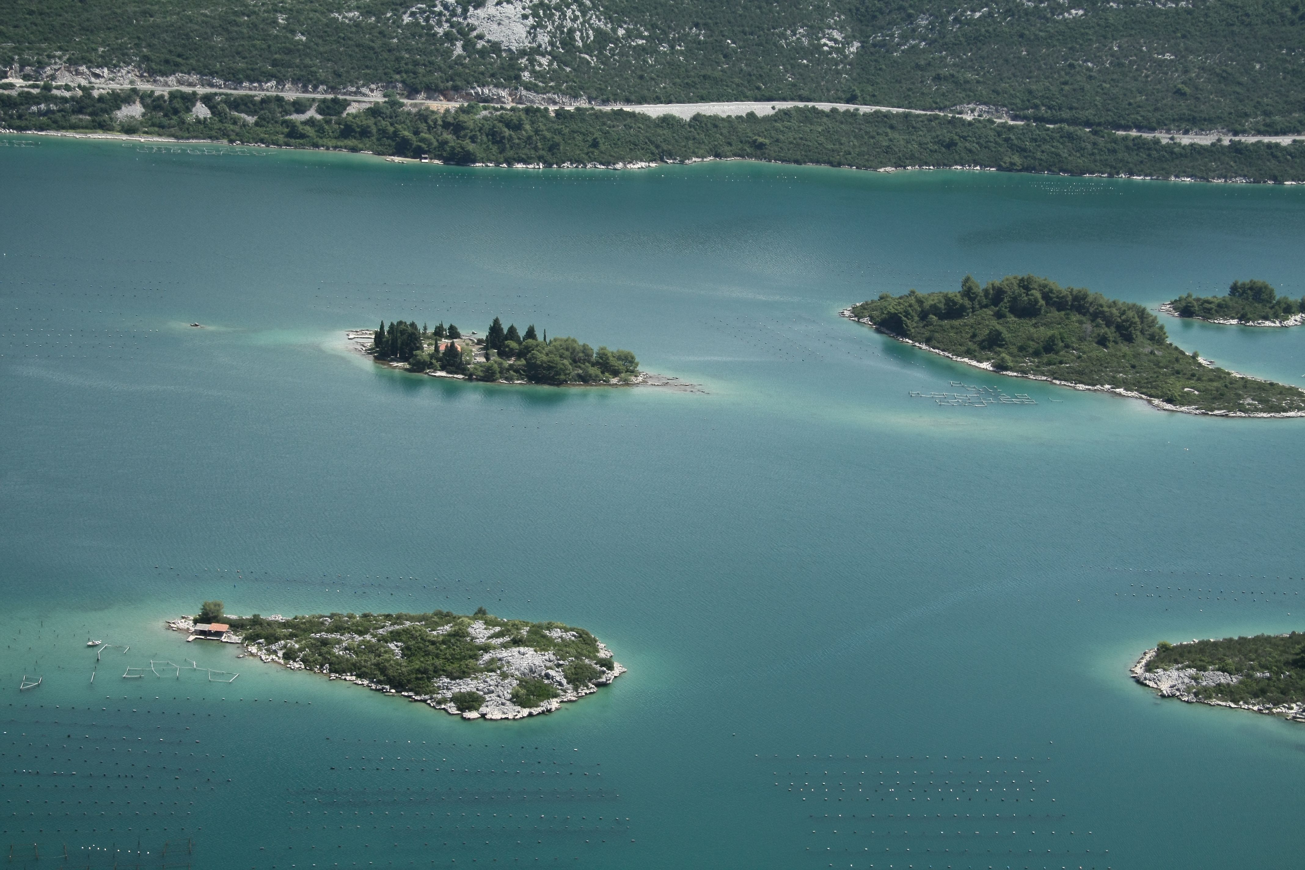
Bay of Mali Ston
Coordinates: 42°55′N 17°35′E / 42.91°N 17.59°E Bay of Mali Ston[ (Croatian: Malostonski zaljev) is a bay in the Adriatic Sea. The bay separates Croatia'sPelješacpeninsula with Bosnia and Herzegovina's Klek peninsula.
The maritime boundary between the two countries is an equidistant line between the two peninsulas. The bay constitutes Bosnia and Herzegovina's only coastline. Part of the bay also separates Pelješac from the Croatian "mainland".
The bay is named after the village of Mali Ston (near Ston). Its southernmost point is at the isthmus of the Pelješac peninsula, while its mouth is located at the point where the peninsula turns westwards, away from the Neretva river delta.
Gundulićeva poljana 1
20230 Ston - Hrvatska
tzston@gmail.com
www.ston.hr


 Povećaj font
 Smanji font
 Crno bijelo
 Visoki kontrast
 Negativni kontrast
 Svjetla pozadina
 Podcrtane poveznice